Skip to content
Tags
Ouster OS0 Ultra-Wide View High-Resolution Imaging Lidar

Ouster OS0 Ultra-Wide View High-Resolution Imaging Lidar

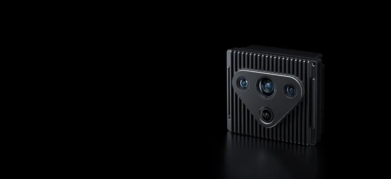
The Ouster OS0 is the Rev8 ultra-wide short-range imaging lidar: 90 deg vertical FOV (+45 to -45) and 360 deg horizontal, 32/64/128 channels, 512-4096 horizontal columns (0.088 deg angular resolution at 4096) and 5-40 Hz configurable rotation. In 1024 @ 10 Hz mode it reaches 75 m on 80% Lambertian targets and 35 m on 10% targets, both at >90% detection probability under 100 klx sunlight, with 500 m max representable range and a minimum range configurable down to 0 m (0.5 m default, 0.3 m optional). Range accuracy is +/-1.25 cm (Lambertian) / +/-2.5 cm (retroreflective) - 2x better precision and accuracy than Rev7 - at 0.1 cm range resolution, with up to 2 returns and 10,485,760 points per second; the 865 nm laser is Class 1 eye-safe. Native RGB-D color point cloud (116 dB dynamic range) carries RGB, range, signal, reflectivity, NIR, channel, azimuth and timestamp per point, with a synchronous IMU at 640/1280/2560 Hz. Data leaves over gigabit Ethernet UDP with PTP/gPTP/NMEA/PPS time sync (<1 ms error) and <10 ms latency. It runs from 12/24 VDC (9-58 V) at 10-20 W, measures 87 mm diameter x 58.35 mm and weighs 500 g (580 g with halo cap); IP68/IP69K, -40 to +85 C (Rev7 was +60 C), 100 g shock, 10 Grms vibration and MTTF over 250,000 h. Engineered for functional safety (ASIL-B, SIL-2, PLd) with an on-sensor 3D Zone Monitor and designed for cybersecurity to ISO 21434 / UNECE WP.29 / IEC 62443 / ISO 27001. Built for AMRs, AGVs, inspection robots, heavy machinery, drones and mapping solutions that need close-range blind-spot perception and high-accuracy 3D modeling.

COMPONENT

LiDAROusterRGB-DUltra-Wide AngleShort Distance
SILICA: Repurposing Diffusion Priors for Joint Glass Segmentation and Depth Estimation

SILICA: Repurposing Diffusion Priors for Joint Glass Segmentation and Depth Estimation

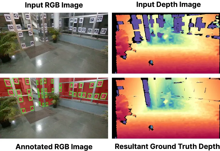
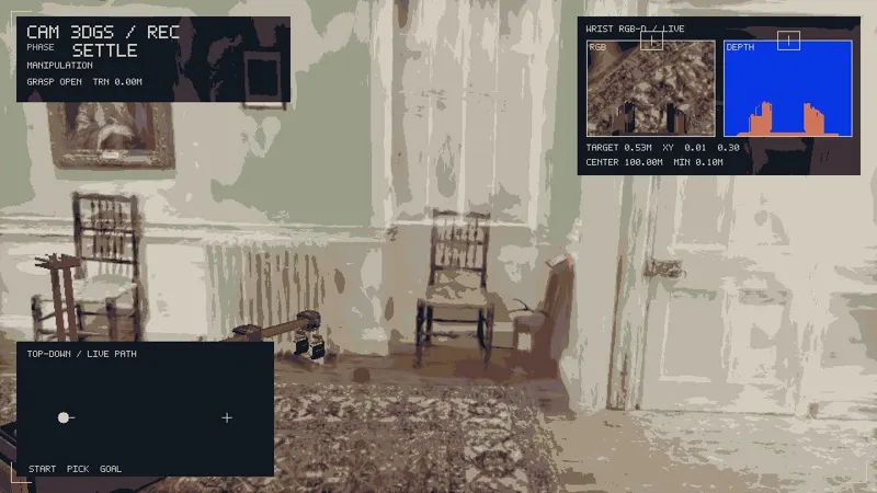
Standard depth sensors systematically fail on transparent surfaces, creating corrupted 3D maps and severe navigation hazards. While specialized hardware sensors can detect glass, they lack modularity and have extensive hardware dependencies. Consequently, learning-based monocular depth estimation has emerged as a compelling alternative. However, domain-specific glass-aware monocular depth estimators struggle with unfamiliar indoor layouts; restricted by the severe scarcity of real-world glass depth annotations, they fail to generalize zero-shot to new settings. This motivates us to explore whether the extensive priors of text-to-image diffusion models can enable generalizable perception of transparent surfaces. We introduce SILICA, a unified pipeline leveraging these priors to jointly predict glass segmentation and glass-aware depth. This mutual information exchange establishes a robust spatial hierarchy, entirely eliminating the need for paired real-world glass depth annotations. Subsequently, we use the predicted segmentation mask to explicitly filter incorrect glass depth points from standard sensors, recovering accurate metric glass depth for downstream 3D mapping and autonomous collision avoidance. Supported by our novel Mirage 18k dataset, extensive experiments demonstrate that SILICA achieves remarkable zero-shot transfer across diverse, unseen environments, outperforming state-of-the-art models by almost 20% and setting a new benchmark for transparent surface perception.

Tarun R, Anuj Verma, Laksh NanwaniJul 27, 2026
RoboticsRobotsJul 27, 2026
Accuracy potential of visual localization exploiting high-end street-level imagery

Accuracy potential of visual localization exploiting high-end street-level imagery

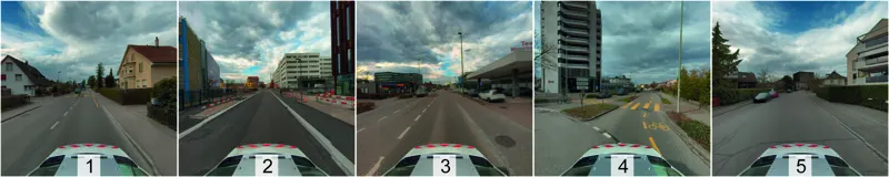
Accurate and reliable pose information with respect to a reference frame is increasingly demanded across applications such as autonomous navigation, surveying, robotics, and augmented and mixed reality. Visual localization can serve as a complementary positioning modality to GNSS, whose applicability and accuracy are often limited. Yet, the accuracy potential of visual localization has not been systematically investigated against survey-grade demands. This is mainly due to the lack of publicly available, large-scale outdoor datasets with ground-truth poses in the sub-centimeter range. In this work, we address both gaps. We introduce a scalable visual localization pipeline that employs precisely georeferenced, high-resolution street-level imagery directly as the scene representation. It combines prior-guided reference candidate selection with on-the-fly local Structure-from-Motion reconstruction and PnP-based pose estimation. We further present the FHNW Muttenz dataset, a real-world dataset covering a contiguous 10 km street network mapped in two mobile mapping campaigns approximately 1.5 years apart. It consists of high-resolution reference imagery and query sequences acquired by four different cameras across five representative scenes. All images are precisely co-registered, yielding 6-DoF ground-truth poses in the sub-centimeter range. Using this dataset, we evaluate the accuracy potential of visual localization. Our experiments demonstrate median pose accuracies in the range of 1-5 cm for translation and 0.05-0.1° for rotation, reaching as low as 1 cm and 0.03° under favorable conditions. These results show that visual localization can complement survey-grade GNSS positioning, paving the way for 3D geospatial data acquisition using consumer devices and fully automated georeferencing approaches. The dataset is publicly available at: https://fhnw-muttenz-vl-dataset.github.io/.

Jonas Meyer, Stephan Nebiker, Pascal TheilerJul 27, 2026
RoboticsRobotsJul 27, 2026